Fall Driving – The Kanc and Sugar Hill
Saturday, 27-Sep-2014
Tags: NH
This was not a hiking weekend, but we got to do some driving/siteseeing in the White Mountains on Friday and Saturday. Although we are still about two weeks before peak colors, many trees had turned already and many were starting, so the views were incredible nonetheless, so we thought we would share some photos.
Friday
On Friday we just drove east on the Kancamagus highway from Lincoln and made four stops. They are shown on the following map.

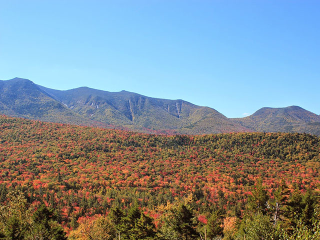
The first two overlooks were on the right side of the road (heading west to east), so they were looking predominantly south from Osceola East Peak (just to the east of Mt. Osceola in the map) west along the Scar Ridge which extends westward almost to Loon North Peak (you can see that in the map).
Here is a shot posted on the AMC Facebook page, photo on the same day by Danielle Jepson, showing Osceola and some of the Scar Ridge.
Danielle Jepson
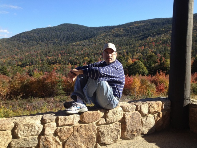
The next two overlooks were on the left side (heading west to east). At the Graham Wangan Overlook the view was primarily to the north into the western Pemigewasset Wilderness area, sort of towards Mt. Carrigain (although that mountain was blocked by closer hills. The following picture was taken at that viewpoint.
The fourth stop was quite a bit farther east at the Sugar Hill Overlook (not to be confused with Sugar Hill, NH which we visited on Saturday and is nowhere near this location). The view here was amazingly broad and was to the north and east, from Mt. Tremont (a great hike from US 302) in the Pemi to Mt. Chocurua and the Three Sisters in the east, and even a bit farther around to Hedgehog Mountain and Mt. Potash to the southeast (two more nice hikes from the UNH trail starting a bit farther east on the Kanc.)
Saturday
Sugar Hill is a small rural town a bit west of Franconia. Saturday (continuing into Sunday) was the Sugar Hill Autumn Festival. Just a lot of local crafts people and farmers with booths in several venues around the the center of the town. It was fun to walk around and see the crafts and buy some apples and some apple donuts, etc. This was another great opportunity to drive around back roads (which the Kanc really isn’t) and see some really great scenery.
The following picture was taken in Sugar Hill near on the venues.

After walking around the Sugar Hill festival for a while we decided to drive down to
Windy Ridge Orchard in North Haverhill, NH. Windy Ridge is a great place to pick blueberries in the summer and apples in the fall. They have a little cafe where you can get sandwiches and baked goods and (best of all IMHO) Apple Cider Slushies.
To get to Windy Ridge we drove several back roads through Easton, NH with some great views.
(Driving note: if you are on Easton Road heading south to route 116, there is a place where you get to a “T”. You have to turn right at the “T” and then a left turn to continue on Easton Road).
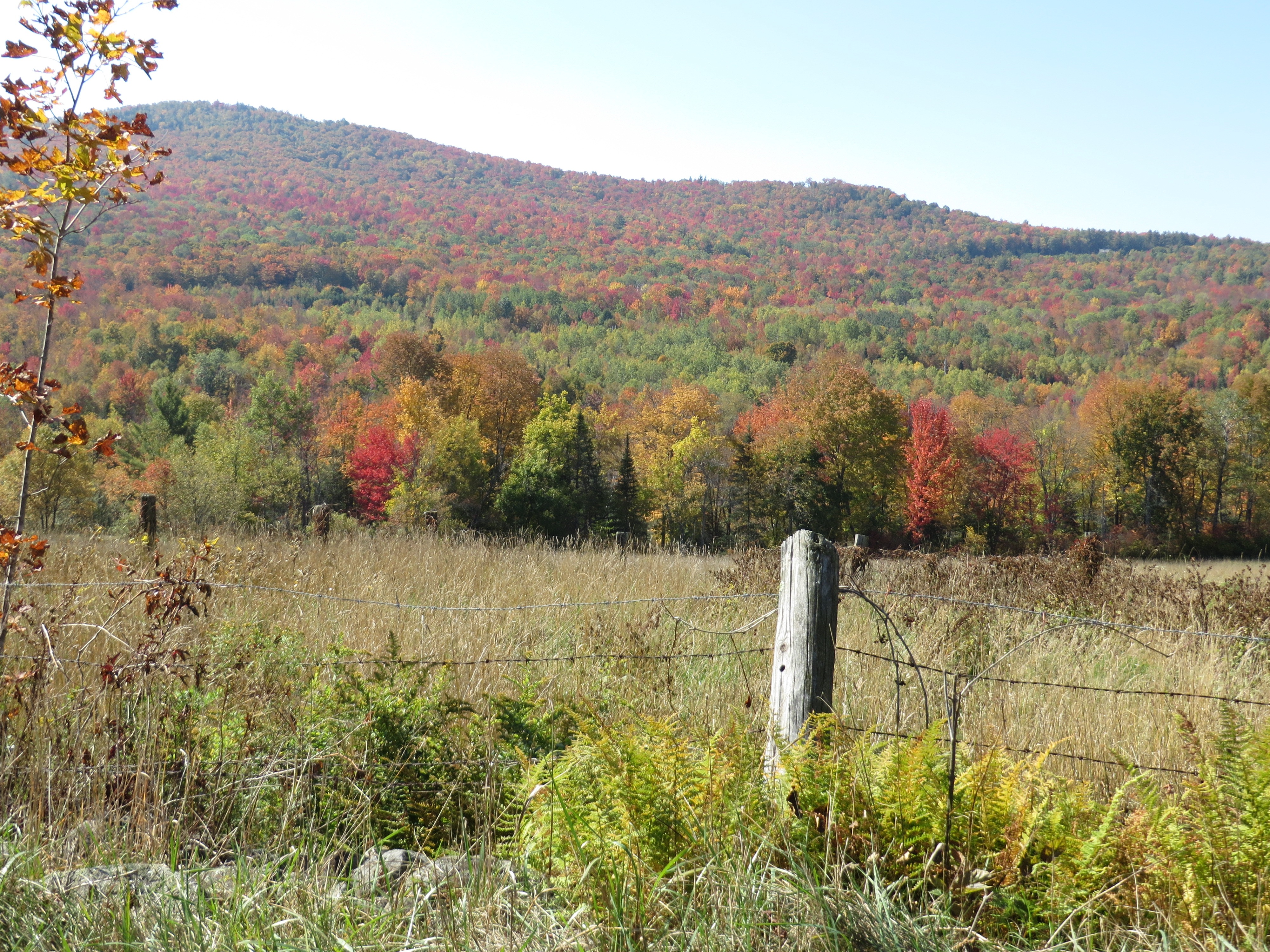
At one point on Easton Road we could get a great view of Cannon Mountain, and Mt. Lafayette from the northwest which is an interesting point of view.

Driving from Rt. 116, turning onto Rt. 112, crossing a bridge over the Ammonoosuc River.

The following map shows the day’s route.
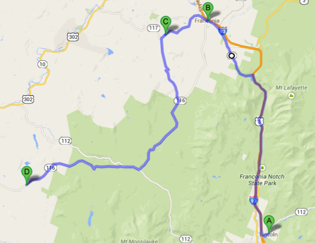
Point A is Lincoln. Point B is Franconia. Point C is location of the Sugar Hill Autumn Festival. From there were headed south on Easton Road which is not a great road but had several fantastic views (including the one of Cannon above). Point D is Windy Ridge. Returning from Windy Ridge was a matter of doubling back on route 116 to 112 and just taking 112 back to Lincoln.
--
Larry and Eileen Samberg